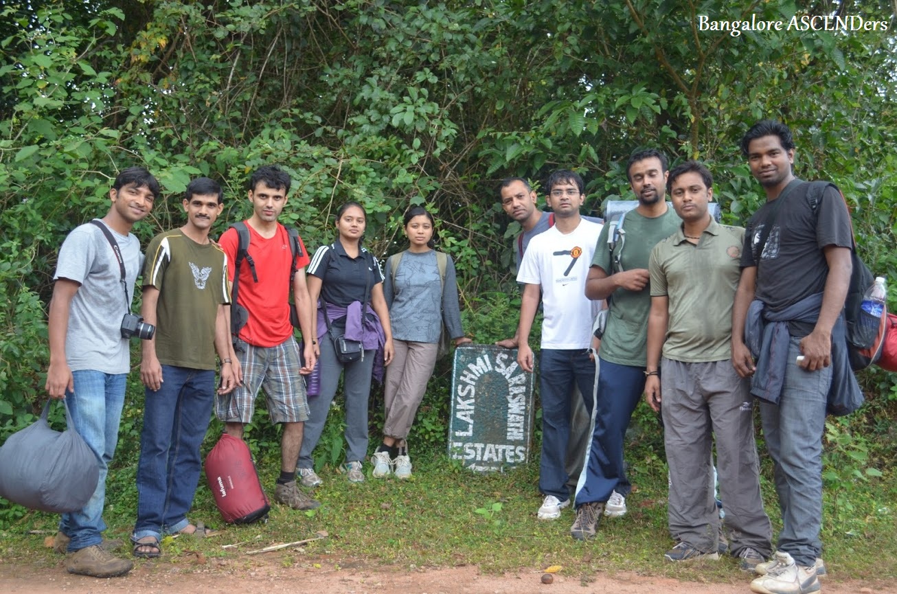
A mystery to be unraveled………
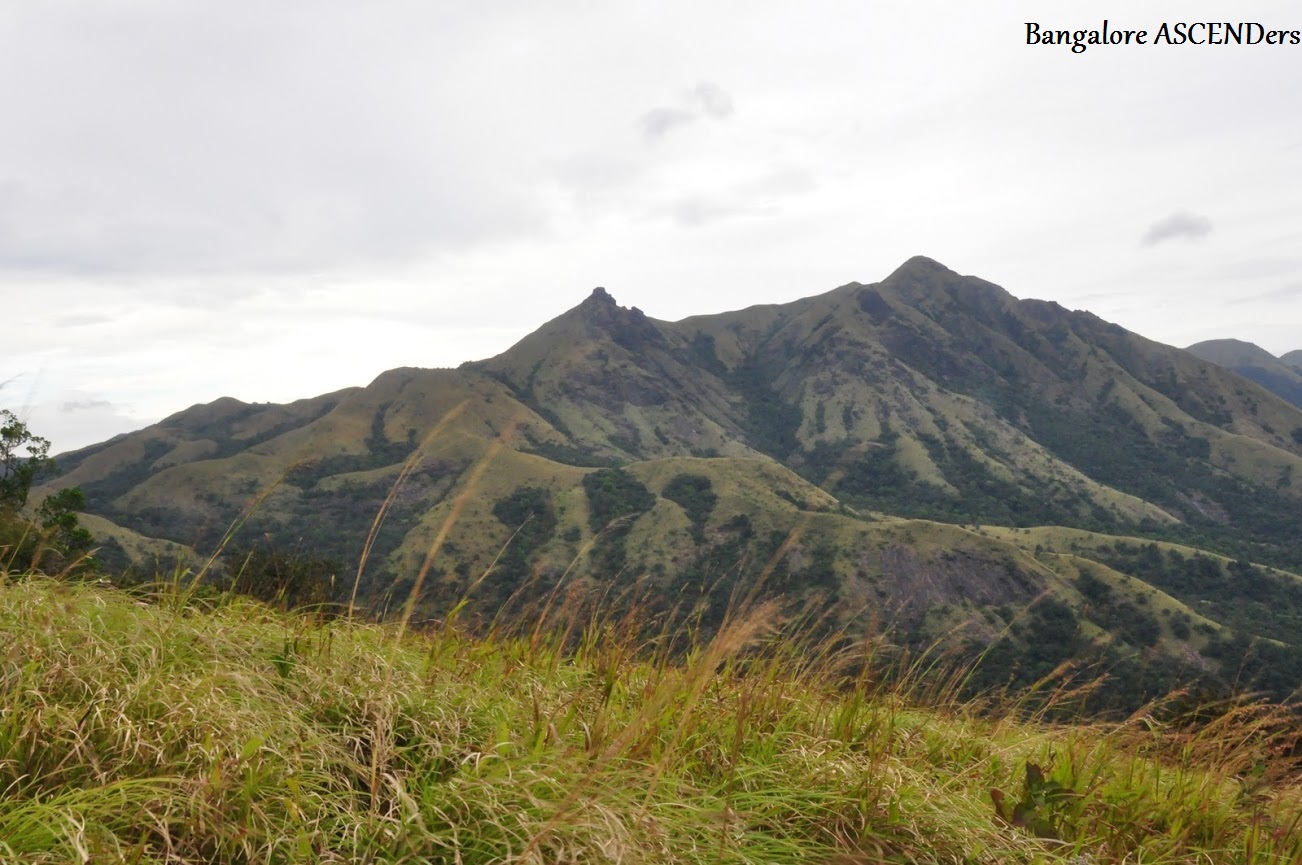
OG or Ombattu Gudda meaning Nine Hills in the native language, Kannada, is in reality a conglomeration of 9 humps which is in line forming a mountain range. Ombattu Gudda is a peak at about 971 meters above sea level, and at a distance of about 20 kms from Gundya Checkpost, inside the Kabbinale Reserved Forest falling under the Sakleshpur range.
My initial brush with the name OG was when I came across a few blogs by some of the trekkers. Although the blogs sounded interesting & adventurous, it never really tickled my senses but was registered in some corner of my brain.
These 2 letters again crept up when one of my colleagues Mudassar (henceforth referred to as Khan) who happens to be a regular trekker, presented this idea of doing a trek to OG with his gang of enthusiastic trekkers from Bangalore ASCENDers. Initially I was apprehensive to be a part of an entirely new bunch of people, but later on the thought of scaling OG prevailed over me & the fact that not many people are successful in scaling the peak made me all the more enthusiastic to take up this adventurous endeavor.
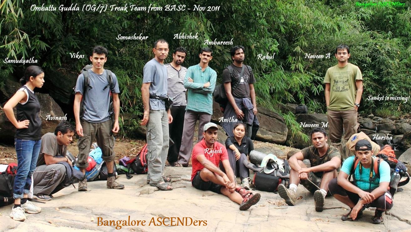
Then on, there was a chain of mails exchanged between the group members, on the feasible dates, the finances, booking of tickets & who all would be available for the trek. The final list had 13 people which again were brought down to 12 due to an early departure of one of the group members even before the trek could start, because of an emergency. The final list included,

Mudassar Khan- (second attempt)
Jayloknath
Krishna Bhat alias KB
Ambareesh Karanth- ( second attempt)
Satish alias Professional
Prasad Rao ( Satish’s friend)
Vivek
Prasad
Girish
Sumanth
Nagesh
Your’s truly Ram.
The dates were finalized as 11th & 12th of May. The departure would be on the 10th night by the KSRTC & the return would be from Chickmagalur on the 12th night. In fact the return tickets were booked in advance, which spoke volumes of our confidence level. The ground work was done in the form of downloading the GPS co-ordinate systems, & google maps of the terrain. Nagesh who had this Nokia GPS enabled handset got everything downloaded onto his mobile. Along with this Khan had the maps from the Geological Survey of India (48 P/9/NW).
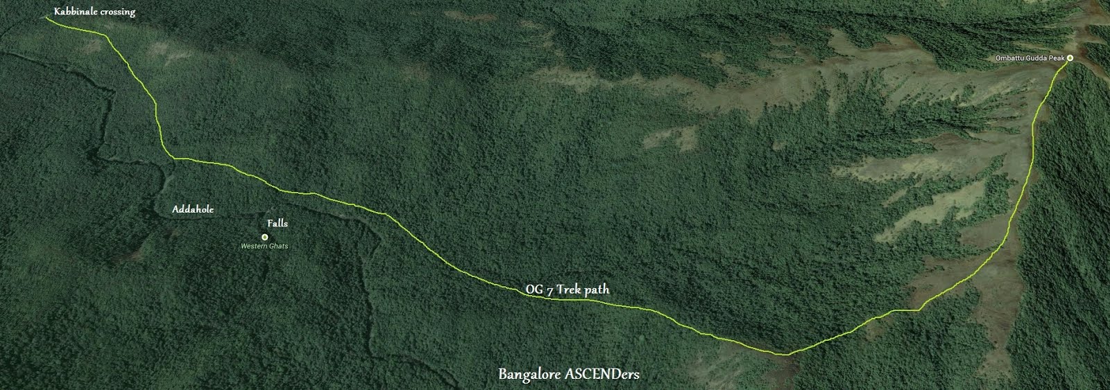
The plan was to alight at the Gundya check post and walk straight through the check post for a couple of kms until we reach a bridge on the Addahole river flowing from North to South. Here we take a right deviation into a path leading to the forest. There are a few houses on either sides of the path which eventually leads into the forest land. Remember, this is the last you will see of any human establishments until you reach the coffee estate. Walk on this track for a couple of hours through the forest cover would lead us to the Kabbinale River which flows along East West direction. This place would be a stop over for the morning rituals &breakfast. Continue to trek after the breakfast along the stream in the North-West direction.
Here I would like to stress o n one important aspect i.e. choosing the path for the reminder of the trek from this particular juncture. Basically there are 2 routes from this point. One route is to take a left from this point trek for app. 30 mts along the Kabbinale river until you find a small stream joining the river. Trek along this stream until it ends in a valley. At this point you will have to ascend from your right through the forest cover until a bald patch of the grassland is seen. Here, align the compass to approximately 30º along North –West & continue further in this direction to reach the OG. This is supposed to be the most scenic & shorter route, but devoid of any source of water once you deviate from the stream. Now, this is like going without water for more than a day which would be unreasonable in the heat. The second route is to follow the Addhole stream that’s basically walking in the north direction. This stream after a certain distance becomes Devarahalla and continues along the valley. We are basically walking upstream all through the trek. At some point the trail ends and we have to literally trek in the river to the point where we take a deviation towards left to reach the back of OG and then start ascending. To reach this point of deviation, would take around 3-4 hrs to from the breakfast point. Also figuring the exact point of deviation is a task in itself as there is no definite path or trail. Now all this was on paper & the actual scenario would be known only after we start walking along. Our idea basically was to trek to a point where we find a water fall (as per one of the blogs). Then take a deviation to the right of the waterfall (which was proved wrong after the trek), again trek for a couple of hrs in the North-West direction. Although the deviation would be to the right, the ultimate goal was to go around the fall & hit the North –West path at some point until we reach the grassland where we would be camping for the night. Wake up early in the morning head towards the back of OG & descend on the other side of OG to meet the jeep track which would lead us to Lakshmi Estate. Ideally this should happen by the afternoon of day 2. Hire a jeep to Mudigere & then travel by bus to Chickmagalur to catch the night bus to Bangalore. This was the itenary planned for the trek which unfortunately remained only on paper. (You will figure out the reason when you read through the write-up).
The D-day finally arrived. Everyone met at the KSRTC bus station. The bus left the station at 9:40 P.M, a good 10 minutes behind schedule. Half the bus journey was full of discussions on our future plans of having a full fledged group with our own blog spots & websites. We also decided to have a much larger & detailed discussion on this once we are on the peak. The enthusiasm level was so high that the discussion on the bus went on, ignoring the fact that there were other people on the bus, fast asleep.
Day 1:
The bus reached Gundya check post at 3: 30 in the morning, a good 1 hour ahead of schedule. This was pretty surprising considering the condition of the Hassan- Sakleshpur highway. Our plans of having some refreshment at one of the petty shops at Gundya went for a toss. This was when one of our members had to lea ve because of some emergency back home. The twelve of us crossed the check post & walked to reach the Addahole Bridge. It was still dark & we did not want to venture into the forest so early, fearing an encounter with elephants (based on a couple of our group members’ prior experience). We decided to rest along the empty patches on the right side of the bridge which actually was the start point of our trek.
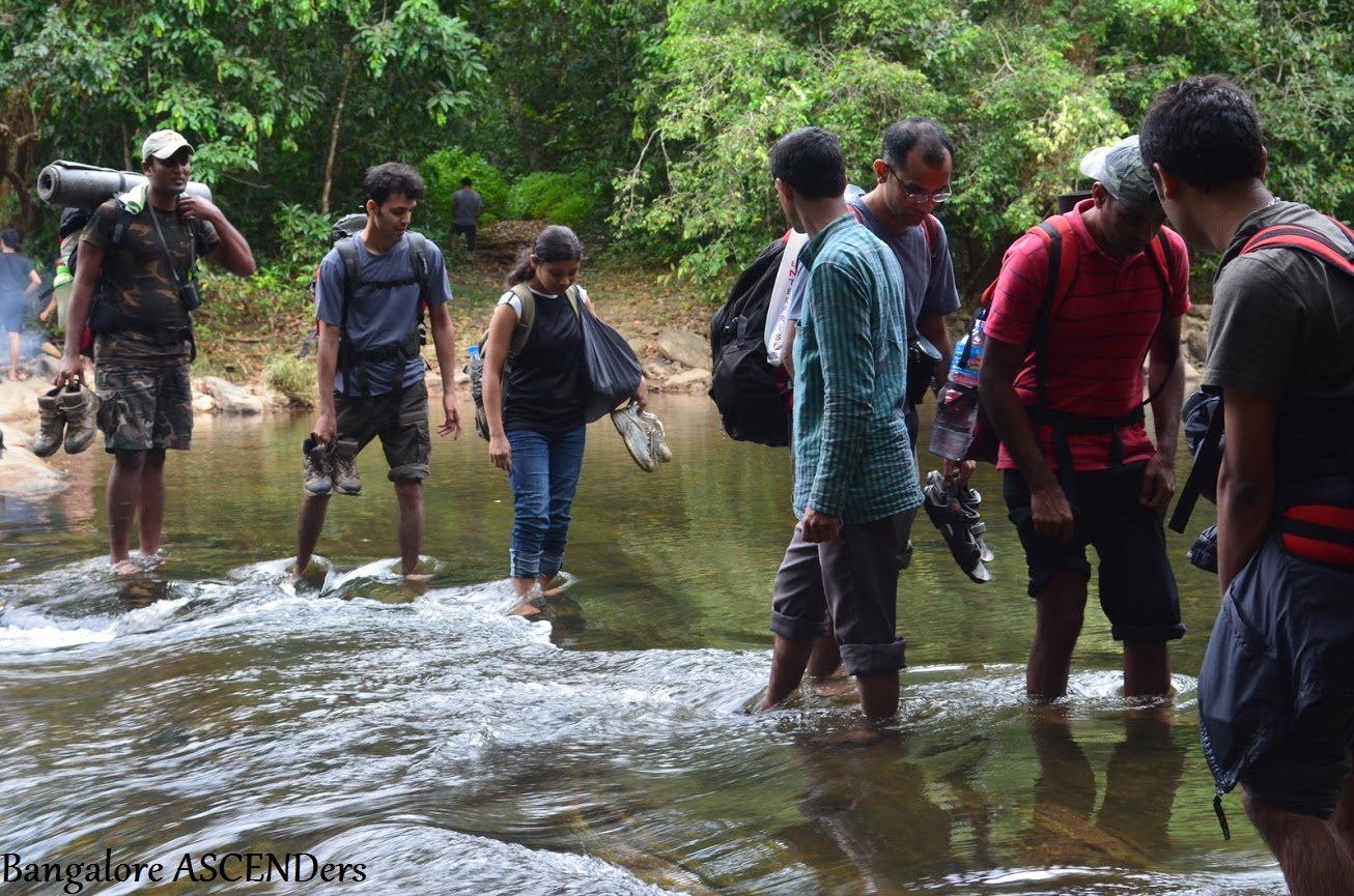
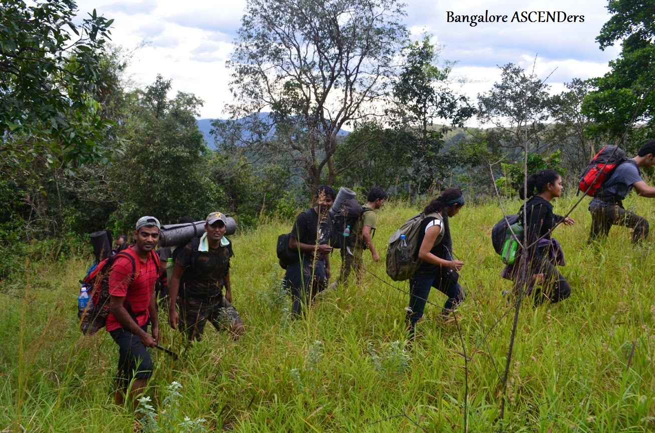
Having rested for a couple of hrs, we embarked on one of the most adventurous treks in the Western Ghats. It was 6:30 in the morning then. With the sun already out, we walked along the trail into the forest. A couple of pictures were clicked to mark the beginning. It must have been over 2 hrs of walking when we hit the Kabbinale River. It was around 9:00 am when we reached the stream. One of the teams which had started early was already at the stream relaxing. The next 2 hrs was spent in & out of the water with everyone having their breakfast & a relaxed dip in the water. The water was super cool to say the least. It was beyond 11:00 am when we again started. With our tummies & water bottles filled, we began to cross the river to reach the other side of it & be able to walk along the Addhole stream amidst some small boulders which formed the path for the rest of our journey. This walk has to be in the direction against the flow of the stream towards North. Hoping to reach the water fall by 2:00 PM, we started our journey.
The path was quite treacherous, with plenty of boulders. It was imperative to be careful about our steps. One wrong step and you have every chance of twisting your ankle. It was not restricted to walking, at some places we had to do some rock climbing as well. We also walked into the forest whenever we found a likely trail & had to come out & join the stream when we encountered thick vegetation. This went on for quite some time. The primary aim was to follow the stream uphill & we were doing it successfully. In the mean time, another group of 4 members joined us in the pursuit of OG. We felt that they were totally lost, & found some hope on seeing us. Every now & then, the maps came out along with the compass to ascertain our route. The same was then authenticated by Nagaraj’s GPS handset. It was now beyond 2’o clock with absolutely no signs of the water fall. We had been walking for more than 2 hrs now with out a break. The heat was getting on to us. It began to take its toll  on Khan, who had just recently recovered from chicken pox. He was totally dehydrated & his body began to throw up any thing that went into it. So we had to take a break. It was like the captain of the ship falling ill. Some of them took this opportunity to have a dip in the water, with Girish & Sumanth finding time to have a puff. I just put my head on one of the rocks & took a small nap. I was sweating profusely with my T-shirt completely drenched. I had a tough time keeping my body hydrated & was worried about loosing the fluids in no time.
After garnering a bit of strength, we started again in search of the water fall which was our initial target. The path ahead was more difficult with the boulders growing in sizes & slippery at some places. My feet were aching badly, but there was no time to think about it since the mind was constantly in look out for the water fall. As we moved deep into the valley, it became difficult for the GPS handset to receive signals & went blank much to the dismay of others. The battery too was draining out. Luckily Nagesh had a couple of spare batteries, which came in handy. We were hoping to find some open spaces for the GPS to receive signals.
The next 2-3 hrs was spent walking along the stream. It was beyond 5 PM when we decided to take a much deserved break. This time it was near the water hole where we found some place to keep our belongings. In the mean time Khan’s condition was deteriorating. He was totally dehydrated & was just not able to eat or drink anything. In spite of this he was trying to figure out the route with the maps. After much deliberation on going ahead, it was decided to camp at the very site for the rest of the evening. Literally we were camping near a water hole & spending the entire night there which in all probability could be visited by our wild friends for a drink. We were virtual invaders of their territory. Preparations were done to light the camp fire; we all had a dip in the water which subdued the pain to a great extent. There is some miracle in these waters, I must say. Every time you step into it, you feel really rejuvenated. It was dinner time. The chapattis, the MTR instant food packets, the breads& any thing that was edible came out of the bags. The camp fire was done with the collected logs & also a small fire place was put up to heat water for the soups & the MTR food packets. In the mean time, the maps were out & some of them got into a discussion on how to proceed the next day. A few others including me were busy cleaning the place and rem oving some of the bigger stones making the place as flat as possible for us to sleep. It was decided that two people would take turns in guarding the place in case of some emergency. Luckily I was spared of the ordeal .I felt guilty about not vol/unteering & thanks for the guys who stayed awake.
In between there were a group of trekkers from CHENNAI TREKKING CLUB who crossed along our camping area & were returning from Jenkal Gudda to their camping site which was around 300 mts away from ours. The fact that they had more powerful GPS device with lot more co-ordinates made their trek all the more easier than ours. Their presence made us feel comfortable & we thought that we probably are on the right track. Also, Khan was asked to rest completely & not worry about tomorrow’s journey. The other group which had come along with us also camped a bit further but they had decided to go back the next day in the same route since one of the guys had badly sprained his ankle& was not in a position to take any kind of risks.
It was a memorable night spent deep in the woods, with the gentle sound of the stream, twittering of the insects & a hope of conquering OG the next day.
Day2: A day of ups & downs
The next day began with all of us finishing our morning duties. Everyb ody was looking cheerful after a good sleep & was anticipating the long journey uphill to OG with great enthusiasm. After having our breakfast, we started to move along the stream uphill. In between all these, we had found a KINGFISHER mineral water bottle placed on a rock supported with some stones the previous day. We hardly took notice of it & never really bothered to ponder over it. Now how grave a mistake was it is yet to be realized. It was around 8:00 am when we started from the camp site. This was our second day & on the way we also crossed the camp site of the CTC. It was an ideal place to camp but we were perplexed to see the amount of littering that had taken place along the camp site of one of the well organized trekking clubs which emphasizes on zero tolerance when it comes to littering.
It was getting hotter in the mean time & after a couple of hours of trekking with no signs of the stream end & the waterfall, there were some disappointed faces. But without loosing hope we decided to stick to the idea of walking along the stream which eventually paid off when we sighted the water fall at around 11:00 am. It was a great moment of ecstasy & relief for all of us. We rested near the water fall for a few minutes, clicked a few snaps & filled the bottles with water since this was supposed to be the last known source of water & the reminder of the journey was in the grassland until we reach the estate. Luckily at this point we could receive the GPS signals & estimated our current location. The GPS pointed to our destination along the North West direction.
As it was indicated in on e of the blogs, we took a deviation towards our right from the waterfall. We believed that this path would lead to the back of OG from where we could start our ascend & get down from the other side until we meet the jeep track, which would then lead us to the estate. But Nagesh, who was handling the GPS handset, was a bit skeptical about taking this route. His doubts were overruled by the other member’s confidence & enthusiasm. We climbed uphill & started to walk along the ridges & away from the waterfall but sticking to the intended direction. Remember the GPS failed to work when inside the forest. The nature had taken over the technology. The path was more or less like a pre-existing trail (not actually though). We also had to deviate a bit from the actual direction due to the density of the vegetation. The path was getting all the more treacherous & tiring. I was sweating like hell & could see water dripping from my clothes. I also had to go slow on the consumption of water as there was no known source of water ahead. The situation was some how managed by loads of grapes which I was carrying. (Thanks to Khan for informing me to carry some grapes which would be a substitute to water). We had spent quite some time walking but with no trace of the grassland. In the process we had to ascend & descend a couple of steep valleys. This was made absolutely daunting, thanks to the loose soil coupled with rolling stones. The person leading should be absolutely careful about not stepping on the stones while ascending the steep. The repeated stepping would render the stone loose & eventually would come off the soil rolling down & could be really dangerous for those coming behind. This was practically experienced when Prasad stepped on a loosely sitting stone, considerably big in size. It just came off the soil rolling down. Jayloknath was just ahead of me & behind Prasad with some distance separating them when the stone came falling down in my direction. Immediately I took evasive action, but Jayloknath thinking that it would fall on me tried to change the direction of the stone with his forehand. The speed was such that it resulted in a big bruise on his forehand (thanks mate for your concern). He was left with a bleeding hand & terrible pain for the rest of the journey.

Soon after this painful ascend, we were lucky to enter the grassland ( whether this was the intended one, nobody knew). This again brought some cheer on everybody’s face. It was around 3:00p.m then, which was a solid 24hr delay from our original plans. By this time, we had given up our hopes of catching the night bus from Chikamaglur. Waiting for the last few to come out of the forest, Nagesh took out his GPS handset to determine our location. To our dismay, it showed that we had deviated quite a bit from the actual direction. So the cheer of finding the grassland was short-lived. This journey was full of disappointments & cheer showered upon us, in installments, by the nature. I was so dehydrated that my legs were beginning to give up. But Jayloknath was always trying to push me in spite of his pain. It was a blessing that Khan had held himself up so far, without any major signs of fatigue although he was looking really pale.
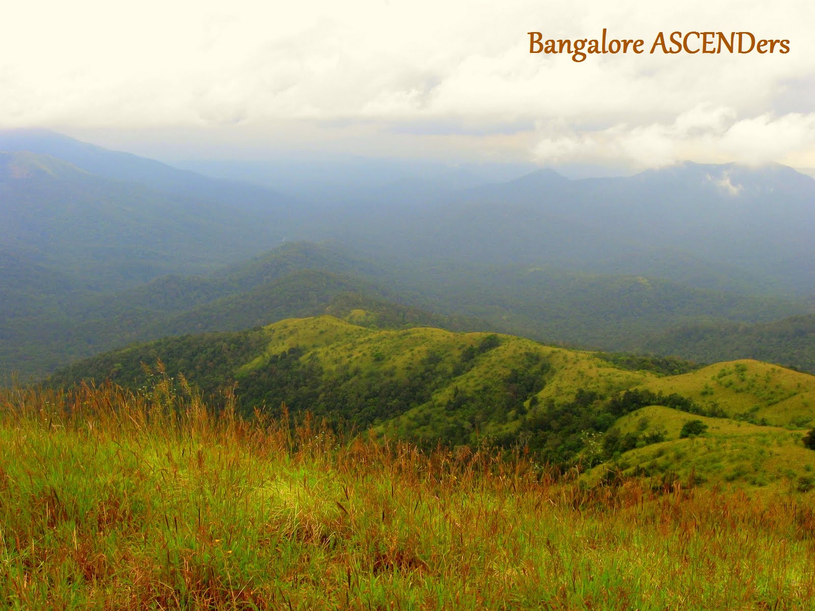
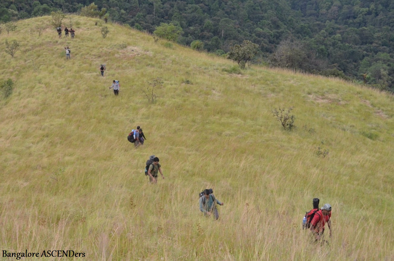
With the much required rest, we again started to ascend the grassland which was getting steeper. It was decided that we would reach the peak of this mountain & walk along the peak without venturing into the forest, hoping to get to OG. Luckily the sun god showed some mercy & had vanished behind the clouds to provide respite from the scorching heat. The steep was almost 80-85 deg I would say. It was getting scary to even look back on the ascend. We had scaled considerable height by now and it was only mountains & forest land all-around. A sense of emptiness started to creep in. At this point Bangalore seemed a distant proposition altogether. Once on the peak it was time to decide upon which peak is the OG because we had deviated so much that figuring out the peak became an ordeal by itself. None of the GSI maps came to our rescue now. All through the jou rney it was Ambareesh who was leading the pack with great enthusiasm even when others were down. But for once we could see his drooping shoulders. Such was the magnitude of the situation. The only option was to back our natural instincts & continue s to walk. There were also talks among a few people to continue the trek into the night irrespective of the dangers involved in crossing the thick forest. The main reason was that people back home would be really worried if they don’t find their wards returning the next day. Imagining them, making frantic calls without being able to reach us on our mobiles made us all jittery. But there was no looking back from this point. There was no way that we could trace the path all the way back. At this point we felt that the group which left us in the morning was the most sensible. Continuing our walk along the narrow path in the grass land we reached a point were the group was split into two. One group along with Ambareesh went ahead to find out how the path was. Khan, Jayloknath, KB, Girish, Suman & me stayed back. It was now that Khan was showing some signs of fatigue again. In the mean time we started to chew on the mountain berries which KB had picked on our way up. These berries are a good source of energy (vitamin C) which was very much required at that point of time. We waited, till Vivek who was with the other group came back & told us about the path ahead. The grassland ended along the fringes of the forest. The other group was resting on one of the rocks when we joined them. We had a much deserved lunch. It was around 4: 00 P.M then. The thought that we have lost our way slowly started to creep into our minds. We had two options ahead of us now. One was to venture into the forest again which was ridiculous considering the time of the day. The other option was to again scale the peak which was on our right to find a suitable place to halt for the
 night. We chose the second option & began climbing the peak. After half an hour or so, we reached a relatively flat area in the middle of the peak. We sat there for a while & were glad to see the Airtel network working at that point. So it was time to call up our near and dear ones & tell them that we might miss the bus & would be late the next day, without revealing the actual scenario. Just when we were thinking of camping there, we saw few foot steps of the pachyderm. Although it seemed pretty old, we did not want to take chance. It was again an ascendance of few hundred meters until we reached the peak. Once on the peak, we were surrounded by different mountain ranges in the Sakleshpur range. It was only mountains till your eyes could see, with dense forest beneath. This was when we came to terms with the fact that we are terribly LOST. Alas, we were F***in LOST in the wilderness. With the bags dropped down & the mat rolled out every body were getting ready to sleep. At this point of time, Khan had lost it completely. He was drained out but was not in a position to have anything as he was throwing up. The glucose packets came out in case of an emergency. The condition we were in, made us believe that we have an emergency situation on our hands. Considering the fact that we may have to trek for another day to reach any kind of human settlement, it was considered unwise to take a chance with Khan. We even went to the extent of calling up DECCAN AVIATION (thanks to Airtel again) and asking for their air lifting services using their choppers. But their exorbitant price compelled us to revert on this idea. Jayloknath also called up his friend who was in the Indian Navy ,if they have any kind of services for such situations. The reply was that the Navy would be pressed into service only when there is a natural calamity like an earhquake or floods. The one major area, I would say, that our country lags is when it comes
 to handling civilian emergency. In the US, the chopper would have been made available within minutes of a distress call to the emergency number and for absolutely no charge. Long way to go, before a common man gets his due in this country.
We all had a good laugh at some of Satish’s one-liners & jokes. For some time, we forgot about our condition & enjoyed the situation. We also enjoyed the scenic beauty around us. It was amazing to say the least. I clicked a few snaps which would definitely serve as a reminder at a later stage on my life. The awesome looking Deepadakallu Gudda formed the backdrop of our place of stay. This Gudda is something which we would not have encountered had we not got lost. By this time, the dawn had begun to set in. The temperature was dropping with the chillness descending on us. Khan was asked to use Vivek’s sleeping bag hoping that he would be fine by tomorrow morning. We came to a conclusion that the hill facing us was the OG. Also we could see a tiled roof at a distance which we assumed to be the Lakshmi Estate. It was also decided that we would venture into the thick forest below & get out of it in the direction of the jeep track. It was supposed to be a complete descend into the valley & ascend half way uphill to the jeep track. The idea of getting on the peak which was presumed to be OG was dropped. The main target was to reach the estate. It was getting darker & colder. It was again decided that two people would take turns in guarding the area for two hrs while others slept. I along with Ambareesh agreed for the 12A.M to 2A.M slot. With my clothes wet & temperature dipping I was literally shiv ering. All that I had was a thin blanket which was rendered useless. We had no option of having a camp fire as well. So, cursing our stars we went into a deep slumber with a small prayer on our lips until the shift guys came & woke us up to take guard. By the time I woke, for the change of guard, the temperature had dropped like crazy & I was feeling much colder because of my soiled clothes. With just the blanket to wrap around I got myself up and literally see stars in the sky. It was an awesome night I would say. Who would have imagined that we would be spending a night in an open space under millions of stars in a place as eerie as this? Nevertheless the experience was great. Every now & then we would switch on our torches & look around for any predators. At the end of our turn, we woke up the next JODI & went back to sleep.
Day 3: (We never expected to get into day 3 when we started)
It  was 6:00 in the morning when each one of us began to wake up. The first thing I heard from Nagesh in the morning was that OG is not the peak in front of us but the one which is adjacent to it. This area had a vast expanse of forest to be crossed which seemed very much unlikely. This information was a result of his study of the maps & the GPS coordinates last night. This revelation again put some doubts in our minds regarding the route that was decided the previous night. With such uncertainity ahead of us, we began the descend wishing good luck to each one of us. Satish recorded his last few words ( just in case!!!) in his camera, hoping that ,even if he get's lost his camera would be found. Everybody had a hearty laugh hearing this. Special thanks to Satish for his lighter moments at times when it was absolutely necessary. KB made a quick call to his wife ( a very emotional one though).It was 6:30 when we started down the hill. The forest cover was really intimidating. We had no clue as to what was in store for us inside the forest as it was dense than the previous ones. This time it was Vivek & Prasad (KB’s friend) who took the lead with daggers in their hands. Khan was looking better and raring to go after a good night’s sleep. We did see some jack fruit trees with fully grown fruits when we were moving down hill. It was a perfect place for the sloth bears to be living around & this place is known to have sloth bears. Throwing caution into air, we started descending into the forest. It was a virgin forest with no human intervention until we entered into it & stole its virginity. The descend again was tediou
 s with holding on to some half grown trees & plants. At some places it was a free fall all together. Prasad (satish’s friend) I must say will hold the distinction of repeatedly slipping & falling by the time the trek ends. After descending for half an hour, we were lucky to have encountered a stream. It was again time for finishing our morning duties. I was also told by Khan& KB that they found some signs of the sloth bear languishing around in the vicinity when they saw some fur on the ground & scratch marks on the trees on the descend. It sent shivers down my spine. We hogged upon whatever was left, & drank loads of water. The best part of the journey was we repeatedly encountered water holes thus reducing great amount of fatigue. Accidentally when one among us just started to ascend, he found a track towards the right of the stream uphill. This was just a couple of meters above the stream. It looked more or less like a jeep track which was hardly used. Although the track was wide enough, it had plants grown all over the place. It seemed as though we were the first to come to this point in the recent past. We could not see any traces of human visit in & around the stream area.
After getting on to this track, we decided to abandon the idea of climbing uphill which was more tedious & tiresome. Instead we d ecided to follow the track towards the right which was less demanding & the path was defined. I guess this made absolute sense & we were sure that this path would lead us to some kind of civilization. There was initial resistance to this idea from Girish & Sumanth since we were totally deviating from our original idea of climbing the hill. They were actually frustrated in the manner we lost our way & this, they thought, was again taking a chance of sorts. But common sense prevailed over us and since the majority was for taking this route, they had to oblige. We began to walk on this stretch. It was around 8:30 am when we started from here. The first sign of human inhabitation somewhere in the vicinity was when one of us spotted a lid of a whisky bottle buried in the road. Ah! Was this a much required relief? The fact that the track was moving uphill was another reason to rejoice. This was also confirmed from one of our maps. There was this much awaited smile on our faces. From then on we began to pick up every single signs of human movements like an abandoned slipper, firewood bundles, a pen cap, a torn piece of a saree so on & so forth. We were sure that this is going to lead us to the estate. It was around 9:30 am. The first sign of the coffee estate was when we spotted a few cows grazing along the periphery of the estate. We moved on, only to find the coffee plantations getting thicker with orange trees in between. We took some time to eat the oranges that had fallen. In the process; the wounds on our fingers came to life when it made contact with the orange juice. That was when we realized the number of cuts & bruises on our hand. It was 10:30 am when we hit the Lakshmi Estate office. We felt like hugging people when we saw them as it was 2 full days spent in oblivion & out of civilization. We were virtually in a no man’s land for 2 days. The joy & relief on our faces was exemplary. With a few hi-five’s, we rested for a while and rejuvenated ourselves with some water. It was told that there is a bus to Mudigere from Hosakere at 12:00 in the noon. Hosakere was an hour’s drive in the jeep from the estate. Hoping to catch the bus, we somehow convinced one of the guys there, to drop us till Hosakere in the jeep and indeed for a price. After initial resistance, he agreed to drop us. We, along with our luggage were cramped up into the jeep. When we were just about to cross the gate, we were in for a surprise when a snake just crawled across the road. The irony
 was that, 2 days were spent in the jungle without encountering any wild life & here we find a crawling bugger. By the time we reached Hosakere, the bus had already left. We had to wait in a shop until our jeep driver made some alternate arrangement. In the mean time, we made a few calls from there & had soft drinks from the shop. The driver came back saying that he has arranged for another jeep which would be picking us up from here after dropping a marriage party. We all decided to go to the nearby pond & have a much required dip. By the time we were done with our bathing & make-up program, the jeep had arrived. We got into the jeep which dropped us near the Mudigere bus stand, from where we boarded a “Suvarna Sarige” bus to Bangalore. Most of us decided to get down at Hassan since we were occupying the last few seats & the seats were not comfortable. Girish & Suman continued their journey to Bangalore in the same bus while others got down at Hassan. I guess they never wanted to take a chance with us again!!! We boarded a Rajahamsa bus to Bangalore at 4:30 PM & reached Bangalore by 9:00 PM. It was a much desired home coming for all of us.
Conclusion:
This trek is a perfect example for team work, team spirit, positive thinking & backing your instincts when you are confronted with an emergency situation. It also paid to have a group of 12 members in the decision making process, as it would have been really difficult to handle the situation if it were to be a 4- 5 members group. Our first reaction after reaching Bangalore was not to think about trekking for the next 3 months at least. Just 1.5 months down the line, there are talks of getting together on another trek along the Kodai- Munnar escape route.
In the mean time, we discussed on were we went wrong in scaling the OG. One of the conclusions was that we had to take a deviation at the palce where a mineral water bottle was kept ( hope you remember the reference to the KF mineral water bottle I had made some where in the middle of the write-up.). This was an identification left behind by the CTC guys. This was right opposite to the place where we camped on Day 1. Now how true this conclusion is has to be ascertained.
I’m confident that my next write-up on OG will be a success story……
Written by:Ram
==========================================================
Adventurous, Thrilling , Confusing, Painfull, Disastrous, Funfull, Fearful, Hilarious these are words I could easily use to describe this trek...
I heard this name ‘Ombatttu Gudda’ in the last Kumaraparvatha trek with my group Bangalore ASCENDers.Khan initiated the mailing process, who was very keen to successfully conquer OG & so were all of us.As usual we had mail from khan regarding OG & again as expected there were debate on the trek date & finally it was decided on April 11th.Usually in the trekking spots there are paths or other indications where one has to follow.But OG has targets areas to reach & no definite path.The uniqueness of OG was getting lost, we put all our thoughts to see that we don’t encounter this uniqueness.The plan was to reach OG from gundya & get down from OG on the other side to reach Hosakere.( It is not easy as it sounds)Nagesh (GPS Naga) has taken the responsibility of GPS & its related maps , path etc.Krishna bhat (KB) booked the tickets & Khan collected all the necessary data, maps & finalized the plan.The trek group was 13 & we all met in majestic & left to Gundya by bus.The trekking start point was Gundya check post. Gundya check post is on Blore – Mlore highway , this the junction where all the buses going to Kukke Subramanya divert from highway.
Day-1
By 4am we reached checkpost & the first twist of the trekking started here.Karthik ,one of 13 got emergency call from home & he has to go back.Now the group size came down to 12 & the concern of our JALAKNATH was addressed.He had expressed ‘13’ was a unlucky number to go for a trek.Karthik would have  felt unlucky to leave the trek midway, but after 2 days we all felt, he was damn lucky to go back.From check post we started walking towards mangalore to reach ADDAHOLE bridge.By 4.30am we reached ADDAHOLE bridge & we halted here for sunrise.
Around 6am we started our actual trek along ADDAHOLE river.By 8.30am we reached a river junction.Here KABBINALE river cuts across ADDAHOLE river.This was our breakfast spot.
There are two ways to reach OG peak, take left walk along KABBINALE river or take right follow ADDAHOLE river upstream to reach peak.(Not easy as it sounds)If we take left along KABBINALE river upstream, we need to deviate early from the river. Hence early exit from water source.Although some blogs suggested that this was shorter route than the route along Addahole river , we decided to take route along Addahole river to gain water source advantage.
After a relaxed 2 hr breakfast, we resumed trek at 10.30am.From here our target was fixed, walk along the river(Addahole) until we get a falls.We kept walking, walking & walking ,,,,,,,,there were no signs of falls.And the tragedy strikes here, & it was from Nagesh.,,,,,,,,GPS is not working.Although it was working for sometime, now it is unable to connect to the satellite, thick forest may the reason.And we were left with our own traditional method Compass & map.But it was of not much use. And it was really getting darker.We did not have the idea of where were we.To make matter worse ,,,,,,,,Khan started vomiting from afternoon.The buttermilk he had in the afternoon did not go well. He was almost dehydrated by evening.We selected a place along river side & halted for the night.It was not a safer for night & we had no other options.Khan, ambareesh & 2 others had been to OG before.But they returned halfway as they encountered lots of elephants & got lost,this story kept running in my mind.But we had decided earlier that 2 will be guarding the group for 2 hours each.And the shift was finalized , as nobody was asking me to guard , I felt lucky & slept.I always liked to sleep in the open sky & watch stars. But this was the moment where I just wanted to go to sleep , so that I woke up in the morning without any troubles.But Prasada was smart enough , he did 3am – 4am shift & made to guard 4am onwards.
Prasad rao was my shift partner.
Day-2
As the sun came out, after breakfast we resumed our trek @ 7am.We had considered falls as one of the reference point to cross over to OG peak as mentioned in one of the blog write-up.We trekked along the river upstream in search of falls , after sometime the belief on encountering a falls was fading away.It was physically demanding to trek along & in the river has there were huge rocks.We kept on pushing ourselves.I heard a noise from the group front & noise was out of joy.Finally we have found falls, this gave us the confidence back & we were all charged up again & the time was 10.30 am.As I stood facing the falls, I could see a pea k on the left hand side.We all believed that to be the OG peak. As per the write up referred, we have to climb over the hill on the right hand side of the falls.Hard luck continued as GPS was not connecting to satellite.
Although the OG peak was on the left hand side, we decided to take right hand side as mentioned in the write-up. (we never thought this would be such a disastrous decision)Finally after quick pit stop & photo session we started again.We started climbing the forest hill. This was one of the toughest terrain we had to cross. It was too steep & it took out everything from us.Khan was getting tired & dehydrated. His vomiting had become as common as coughing.He was brave enough to keep pushing himself.In a short time we attained good altitude.Our idea was to be as close left hand side (falls) & cross over this falls river from top.But this never happened. The valley on the left hand side was getting deeper & deeper, we could never go to left.Also we did not wanted to lose the altitude gained & thought we could cross from hill top.We went on climbing the hills only to reach the sunny grasslands.But ‘Surya Bhagawan’ was kind enough to stay within clouds.And we kept on going from one hill to another & without knowing exactly where we are heading.Oh god,,,,,,,,,,,,, what a good news from Nagesh, GPS is working.We all were relieved & overjoyed. It was like oasis in desert.,,,,,,,& the time was,,,,,,,1pm.And this joy was short lived as he showed us the map with locations.We have deviated too much & over-shot our target point.To reach OG we have to cross 2-3 hills & pass through thick forest valleys.
There was panic among group now. Many have not informed at home that the trek could extend. Some were very eager to reach home by next morning & very rightly so.But trekking at night in thick forest infested with bears is more risky.Now we were left only with 2 options either take risk cross all this hurdles & go forward or go back. There was no point was going back, as it would take another 1 ½ days.We decided to go forward.
As luck goes, we got Airtel network signa l at one point & called up home, informed them that we missed the bus & will reach Bangalore by Monday evening.(To be frank we were not sure of reaching home at all).
It was not easy to cross the hills, the only way was reach top of the hill & cross from top.We were running out of water & food. Not sure at what time we reach some human inhabitants place or water source, each drop of water was precious.But there was one point, where we had to enter thick jungle & reach the bottom of the jungle to climb over to the other hill.I’m sure this was part of jungle should a virgin jungle never touched by humans.As proverb goes ‘Fortune favors the brave’, as we were entering the deep valley we found water source. how lucky we were ,,,,,,,,,,,,,,,,,,,,,,after filling up the bottles we started the up hill.Finally @5pm we were standing on a peak facing OG.A thick deep valley was separating us from OG. The only option we had was to getting down in to this thick forest & climb up to reach OG.As it was getting darker, we decided to camp in the hill top for night.But khan’s health was getting worse, he was totally exhausted.
We were not sure of khan’s health for the next morning, this was an serious issue.
It was like gambling one’s life. In case his health worsens more, he would really need medical attention, which was no where near.By god’s grace we had network signal & called up our friends.We decided to check the only emergency option if in case.I called by friend shyam & told him to enquire about air lifting possibilities.The answer we got was, there were no helicopters, most of them are on election duties.If at all available it cannot go beyond 200 kms without refueling. Also the cost was around 5 lacs.All this were not encouraging sign.Unlike U.S. we don’t have airlift options from government.It again proved we are just a common man in India no matter what.The only thing we could do was pray God & hope for khan's fitness.Although there was no panic, anxiety in the group, surely there was some worry.

Few questions crossed my mind:-
Khan’s health
Is the hill facing is OG or some other hill?
Can we cross this jungle safely?
Do we have a chance to see the civilized world again?
Everyone had there own apprehension,
Jalak was missing his wife,
KB too was missing his wife.
Girish & Sandeep ran out of cigarette stock.
Khan was praying for a good sleep.
As sun went down, we all prepared for sleep. And the rotational ‘Team Guarding’ exercise was followed. Again myself & Prasad rao got 4-6am shift.We played cards under moon light till the sun came out.
Day-3
Khan woke-up & was looking fit & refreshing.As decided we entered the thick forest valley in the morning.After an hour of trek, luck strikes again as we reached the bottom of the valley,,,,,,,,,,,,,,,,,Water ,,,,,,,,,,,water ,,,,,,,,,,,,,, .We got fresh here , had breakfast & resumed the trek.As we just crossed the river & started uphill, we reached a man made path , it was wide enough for jeep.Now after team discussion we decided to follow this track hoping to reach a human habitant place. Although this was instantaneous decision, many had a gut feeling that this may lead to some habitation place.After an hour of walk along this track we reached a coffee estate & followed by few houses. This was most rejoicing moment. Then we requested the driver of the estate there to drop us to Hosakere. He finally agreed after narrating khan’s health condition.
Finally we reached Hosakere, bruised, with scratched hands & legs.Spent few relaxed moments in village water canal took bath & left to Bangalore.And we know to reach Bangalore from Hosakere is a cake walk & we did so ,,,,,,,,,,,,,,,,,reached Bangalore in the late evening.
Visit our Group @ CLICK HERE
Join Bangalore ASCENDers @ CLICK HERE
Written by: Satish alias professional
Trek organized by:Mudassar
Image Gallery:
Satish,Nagesh,Ram

 For me the trek really started when I was woken out of my sleep at 5AM in KSRTC bus. Within few minutes we were off the bus and marching in dark terrain guided by Patrick's GPS and our torch lights. It seemed as if a bison or elephant might be lurking at any corner to pounce upon us. That set the theme for rest of the trek.