PAGE UNDER CONSTRUCTION
Monday, November 23, 2009
Monday, November 9, 2009
Posted by
Mudassar
on
Monday, November 9, 2009
11:47 PM
with
2
comments
Objective: Tadiyandamol Peak (Highest peak in Kodagu)
Other places of interest: Nalknad Aramane. Date: November 7th 2009
Grade:Moderate
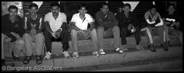
Participants: 10 members (Ambareesh Karanth, Arun, Ganesh Ture, Girish V, Harish, Kiran, Murali KG, Prasanna Ganapathy, Sandeep, and Vinayaka)
About Tadiyandamol :-
Tadiyandamol, the tallest peak in Kod
 agu, is another trekker's paradise. From the peak you can view the distant Arabian sea and the spell-binding beauty of Kodagu all around.The best time to visit Tadiyandamol is early winter. "Highest Point" as called in Kodava language, this peak is the highest one in the Madikeri district. It is situated near Vira Raja Pete (Virajpet), about a 30kms away, on the way to Napoklu, Bhagamandala. This peak is just adjacent to the Makutta forest. On the way, you also get an old palace called 'Nalknad Aramane'. Tadiyandamol is 260km from Bangalore.
Nalknad Palace :-
Built by Dodd
 a Veera Rajendra in 1792 A.D. safe in the depths of a dense jungle at the ba se of Tadiyandamol, this elegant two-storied palace served as the last refuge for Chikka Veera Rajendra before he surrendered to the British in A.D. 1834. Ornamental pillars and verandahs with carved windows and door frames are its notable features. The roof here was originally thatched. The Cobra looked upon as a Scourge & Savior is common in these parts of the region. It inspires fear, but also plays an important role in controlling rodents which are its normal prey. The Cobra symbol carved in various places in the building was probably meant to warn enemies in times often plagued by intrigue.
An irregular trekking route from the summit goes straight to Bramhagiri hills. These hills (1340 mts) can be seen far off towards from the south of Tadiyandamol.
Route 1: Bangalore - Mysore - Hunsur - Periyapatana - Siddapura - Napoklu - Kakkabe - Tadiyandamol.
Route 2: Bangalore - Mysore - Hunsur - Tithimathi - Gonikoppal - Virajpet - Kadanga - Kakiambi - Tadiyandamol.
Route 2 is longer than Route 1. But one can easily reach Virajpet in KSRTC bus from Bangalore. From Virajpet there is enough number of private buses to Kakkabe. Only one Rajahamsa is available to Napoklu from Bangalore. There is no need of any Forest pass or guide for trekking. Be prepared to encounter leeches.
Tadiyandamol, I was going for the first time and as
 I organized this event, lots of data was collected (readings blogs, calling people). Finally we a team of 10 from BASC, started our journey from Bangalore in a Rajahamsa Bus to Napoklu on Friday night. Safely reached Napoklu by 5:30am via Virajpet. After enquiring at a milk booth, got the information that there is a bus at 6am to Kaikamba. All could sleep during night journey , as road was good. We spent 30mints in bus stop, it was still dark. Bus came on-time, it’s only 15km ride. We got down in Aramane stop (Kaikamba). To go to Tadiyandamol peak, you have to get down at the Aramane stop which is before a place called Kakkabe (if you are coming from Virajpet). We need to walk 3km to Aramane in a tar road. On both sides we can see Coffee estate, and mountain range all over. It was a pleasant journey, and was very steep. We reached Nalknad Aramane/School by 7:30am. Aramane (Palace) and School are opposite to each other. Both were closed as we were too early. ( or may be, as in one blog was mentioned that Aramane was closed for renovation). Its old two-storied building buil
 t in 1792. We did all our morning chores at a nearby small stream. Had breakfast and started climbing towards peak by 8:30am.
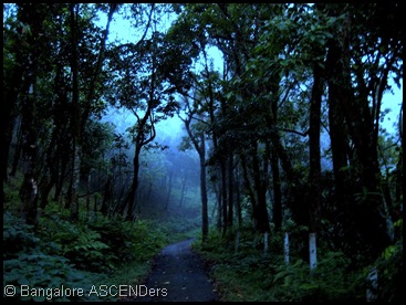
Very steep narrow tar-road with dense forest on both sides, which leads to a forest check-post. Its around 4-5km steep climb. We walked very slowly enjoying nature. The only color we could see was green, the only sounds we could hear were that of the leaves, winds and birds. We met Forest Guard en-route, he warned us not to stay on the peak because of elephant activity. Later we heard the same from workers also. Few days before on a early morning two elephants had attached these workers.
After we crossed forest check-post, the mud road was narrow and had average ascent. From here it’s only 2km trek to the big rock, this was our planned night camping place. From here 5-minutes descend on left path, will lead you to a stream, which happens to be the last source of water. Continue straight besides these rocks to the peak. The trail is very narrow, one at a time can go. On bot
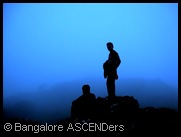
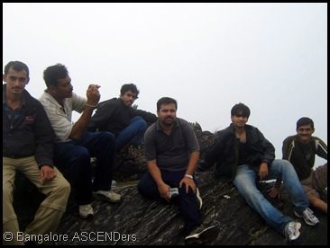
 h sides we can see the vast expanse till the reach of your eye there are green clad mountains. This stretch of the trek was particularly scenic. Clouds drifted past us speedily and the hills that were flushed with sunlight a moment ago were shadowed by dense patches of clouds. Due to mist we did not get good view. By 11:30am we were on the peak. Once on the peak, we felt we were on the clouds. The winds zipped past us, opening us up, alternately, to shadows and lights. Nothing was visible because of thick mist/cloud. We took snaps,had snacks and spent good one hour on the peak, enjoying nature. We introduced ourselves as, many were new to me, since this was my first organized event for BASC.
We came back near the big rocks by 1:30pm, descent was slippery, but the nature was fantastic. Our luck changed, as mist cleared;we stopped at many places to take photos and were deliberately sl
 ow. We had lunch and discussed our next plans. Due to mist and elephants, no body was willing to stay a night here. Many options were discussed, finally we decided to walk down to Kaikamba. By 4pm we came down to Kaikamba. Myself and Murali wanted to spend Sunday here in Kodugu, after all we have traveled all the way from Bangalore to here.So five people headed to Bangalore via Virajpet and five of us went to Bhagamandala via Napoklu.
Tadiyandamol is a perfect one-day trek. And it is a moderate grade trek.
Many thanks for all, who showed interest and participated, all were supportive and sportive throughout the trek.
Visit our Group @ CLICK HERE
Join Bangalore ASCENDers @ CLICK HERE
Written by: Ambareesh Karanth
Event organized by: Ambareesh Karanth
Contributors: Girish V
Image Gallery: Arun,Prasanna Ganapathy,Girish,Kiran,
Subscribe to:
Posts
(
Atom
)


